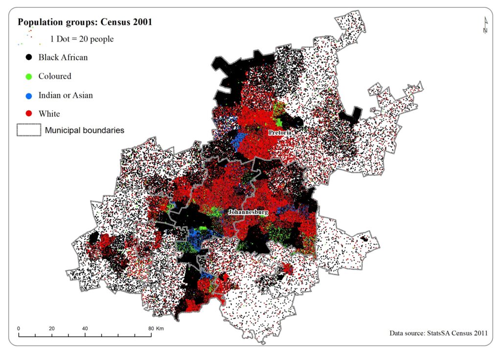
Inner-city, informal and township formal: The sites and the node
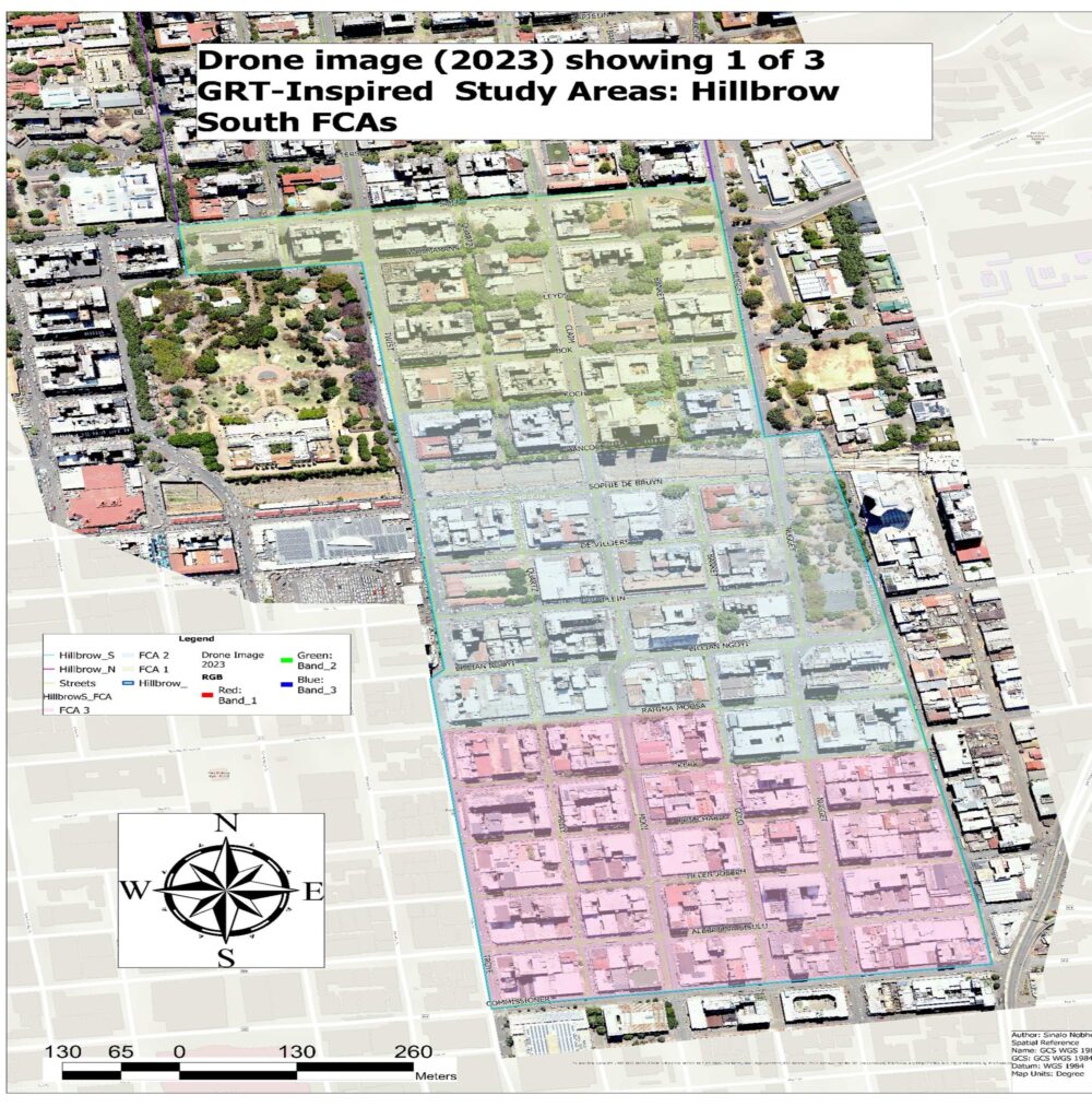
All HDSSs operate in the same space, collecting longitudinal data on everyone living in that space, and tracking those who have newly arrived or who migrate out. The GRT-INSPIRED HDSS deliberately sought to include the major urban forms in Gauteng and so split the site across different sites – Hillbrow, for inner-city high-rise living; Melusi, for informal, and Atteridgeville for township formal, backyard and informal infill. Using sub-place boundaries from State SA, Hillbrow (where we are seeking data on ~40 000 people in the selected Small Area Layers (SALs) – see maps) is divided into two parts: 20 000 from Hillbrow South including Berea, where the University of Johannesburg manages all our work; and 20 000 from Hillbrow North, where Wits RHI is in charge. The population of Hillbrow is far larger than this, but many live in ‘captured’ buildings that are predominantly inaccessible to fieldworkers. The night-light heat map shows the high densities in Hillbrow, which dwarf those elsewhere in the province.

The University of Pretoria is responsible for Atteridgeville (where we target a population of 50 000 within the SAL boundaries) a combination of formal and backyard dwellings (Atteridgeville) and residents of a large informal settlement (Jeffsville); and near to Atteridgeville in Pretoria west is Melusi (where we gather data on 10 000 residents), a slowly formalising informal settlement. The selected SALs from Statistics South Africa form a contiguous space for each site; the three sites together comprise the node.
Hillbrow
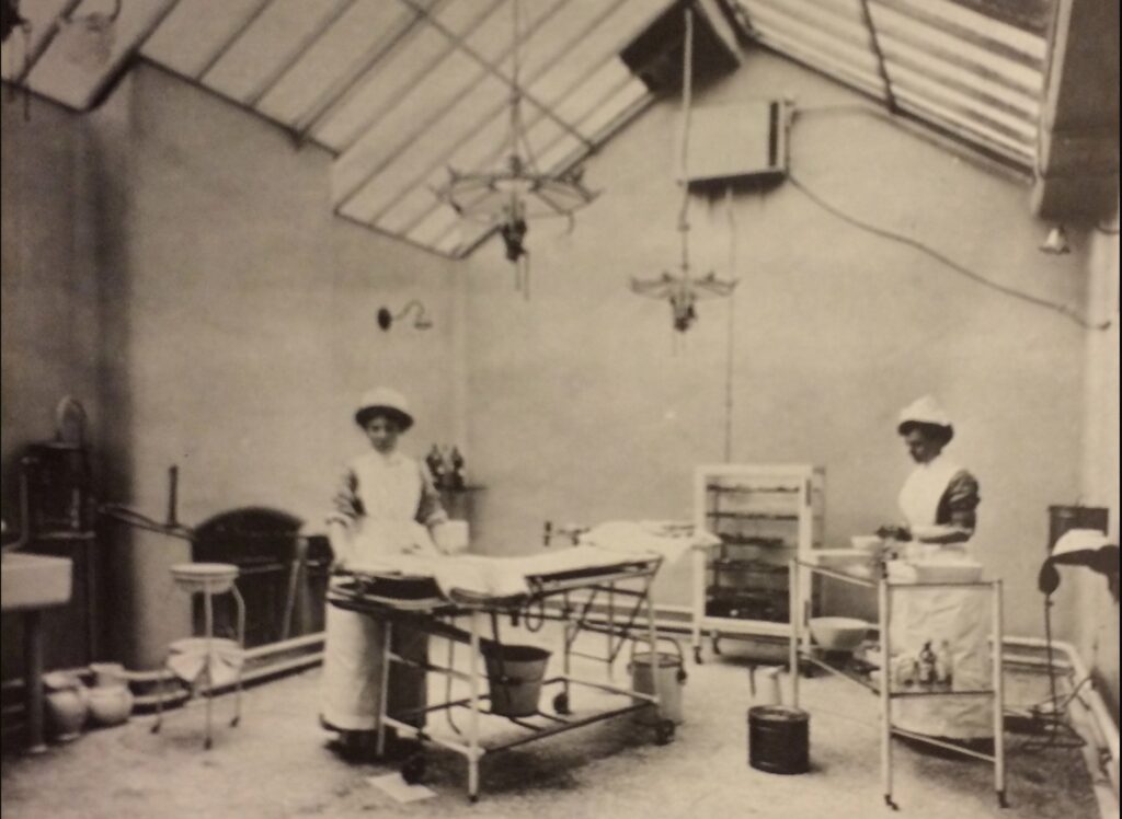
Hillbrow is an area in Johannesburg, located at the heart of the city. It is a residential area named after the rocky ridge found in the city and was the site of Johannesburg’s very first hospital after gold was discovered in 1886
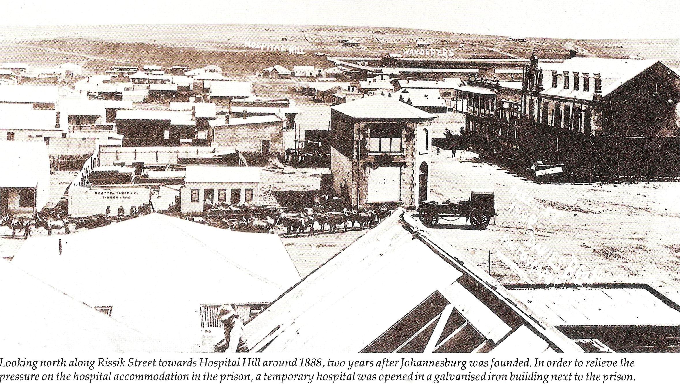
This area is known and identified by its four most distinct landmarks namely: the Ponte apartment building which is one of the tallest residential buildings in Africa, at 173m tall; the Hillbrow Tower, Constitution Hill, and Joubert Park. After the city council government removed the restrictions on building heights in 1946, Hillbrow became home to the tallest skyscrapers in the country. In its history, Hillbrow has always been a residential area, which mixed residential hotels with owner-occupied apartments. This changed dramatically in the 1990s, as mortgage bonds became near impossible to access, and existing residents sold up and left.
Hillbrow is known to house a large of people, living in high densities, attracting many migrants (we have enumerated over 100 nationalities in Hillbrow) and refugees. In the 1970s, it was a destination for mainly European migrants, so some continuity exists. Currently, it is a hub for black African migrants. With the rise of rental (over owner-occupier) space, and concurrent drop in property values, the area increasingly fell prey to ‘crime and grime’. What was once a safe suburb is now notorious for crime. Some landlords simply fled the area, and criminal gangs have taken over buildings, demanding rent from the inhabitants with very few if any services in return. However, like most of central business districts in the country, there are attempts to return Hillbrow to its former glory. And people actively want to remain there, close to the central business district of the city as well as suburbia, all of which offer employment opportunities.
Moreover, through ‘urban heat island’ effects, the inner city is especially vulnerable to the rising temperatures associated with climate change and has high rates of mortality and morbidity during heat waves. Our multidisciplinary approach ensures that we ask questions about severe weather events/climate change, and collaborate with climate change scientists, helping model the relationship between heat and disease now and into the future.
There is not much expansion anticipated for his area because of where it is situated. Below is a map showing the location of Hillbrow:

The population living in inner cities across South Africa make major economic and cultural contributions to the country, have complex demographic characteristics and health needs, and yet are often neglected in health and other forms of research in the country – not least because they are so hard to reach. In many ways, the health and well-being of inner-city population benchmarks the health and wellbeing of a nation. As in many inner-city areas worldwide, these populations in South Africa face amongst the highest levels of crime, road traffic injuries, substance use, air pollution exposure and litter in the country.
Atteridgeville is a predominantly black formal residential township located 13km outside Pretoria/Tshwane. The advent of this area can be credited to a white woman named Myrtle Patricia Atteridge, after whom it was named, who was ‘Chairman’ of the City Council’s ‘Committee for Non-European Affairs’ in the 1930s – Atteridgeville was founded in 1939, less than a decade before apartheid. The area was specifically built to house black people and offer better living conditions than nearby Marabastad, from which people were moved. It is now a multi-cultural society, famous for the love of jazz music and soccer. The Lucas Moripe stadium is one of the notable landmarks of the area.
Atteridgeville
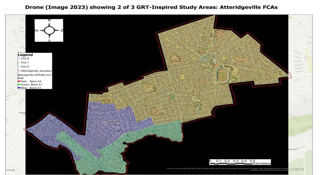
Although still a formal settlement, development of the area was stopped during apartheid and over the years there has been an encroaching informal settlement, Jeffersville (also known as Jeffsville and, tellingly, Gomorrah), which is expected to expand. There is also a proliferation of backyard structures, and informal infill in the area. Unlike Hillbrow, this site is built on open land and expansion – managed or otherwise – is inevitable.
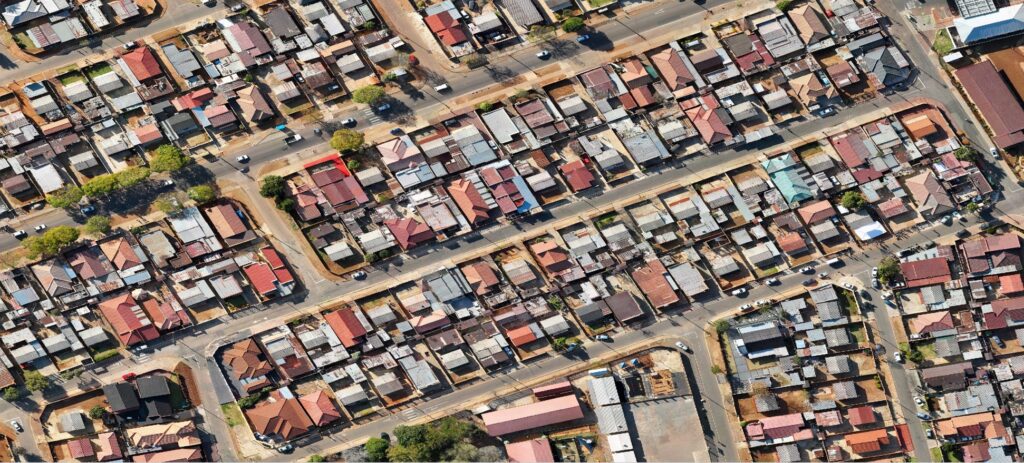
This is why GRT-INSPIRED introduced annual drone flights, to measure spatial change in precise detail. The map below shows where Atteridgeville is situated:
In Melusi and Atteridgeville, the UP Department of Family Medicine and their links with the Steve Biko Academic Hospital are critical. The development of Community Oriented Primary Care (COPC) by UP Family Medicine has had a significant impact on the education of students in the Health Sciences and other faculties at UP. Medical students rotate in the community sites from the first to the 6th year in LCAS (Longitudinal Community Attachment for Students) and students from other faculties engage with these communities and services through the UP-Community Engagement Programme that involves thousands of students. Built on the existing community engagement of UP COPC Research Unit, community engagement is an integral part of GRT-INSPIRED. Community Health Workers are by design recruited from the same community that is served. This means that those working in projects and the service already represent the experiences and views of the community.
Melusi
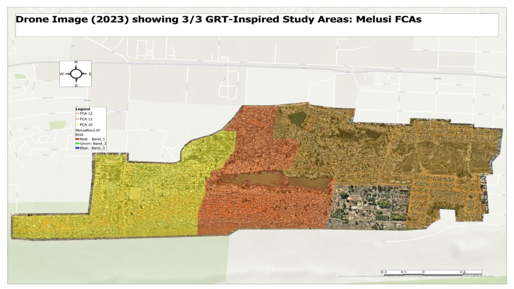
Melusi is a relatively new informal settlement in the city of Tshwane. Melusi in many ways typifies the urban crisis in Gauteng, where population size and demand for housing far outstrips supply. What was a large field with open space, with a nursery and a former quarry, saw a few shacks appear in 2008, then became a settlement over a short period of time, showing exponential growth and poor-to-no planning. For the most part, conditions the people of Melusi live under are poor, with no (legal) electricity, water or sewerage for the people. They rely on community tanks for water and portable toilets. Over the years, a small section of Melusi was formalised by local government, giving people ownership of the land they built their houses/shacks on. A huge part of Melusi, however, is still informal and is the area that expands the fastest. The central part of Melusi is a dam that is a result of an abandoned quarry. The water is separated by a scanty fencing from the dwellings. Over the years, this has proven to be a health and physical hazard for the community.
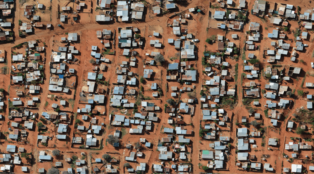
Compared to the other GRT sites, this is the fastest growing settlement. It is essential that a drone image for this area is captured regularly without fail, to help monitor its growth. The figure below shows a map of Melusi:
The Node
These three sites taken together comprise the node and offer SAPRIN a remarkable range of urban form and socio-economic status, providing a richer, more nuanced, and more accurate representation of urban Gauteng than any single site.
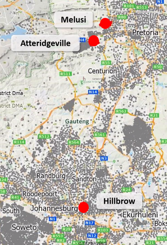
This complementary set of sites which comprise the node easily meet the population threshold of 100 000, though severe challenges remain in areas such as Hillbrow with its captured buildings. Importantly, all sites are strongly associated with GRT partner’s (Wits RHI, UP and UJ) presence on the ground in health outreach, clinical trials, testing, clinic and COPC (community oriented primary healthcare) services and hospital links, extension services, and on-going community research. This obviously informed our choice of sites. Existing relationships and partnerships with the communities in the sites, particularly around health interventions, are strong; so are other community relations and research projects (into urbanism, migration, poverty, sex workers, substance abuse and so on).
In part, this dispersed approach reflects our desire to include a range of different urban forms, rather than locate the HDSS in one, to provide a greater richness of analysis and understanding of the relationship between urbanism and health outcomes. The complexities of Gauteng’s urbanisation patterns demand sensitive treatment.
The Gauteng fieldwork challenge: access
GRT understands that the key challenge for fieldwork in Gauteng is access. Gauteng is the most densely populated province in South Africa, and most densification is racialised, often also ethicised – and wary. Regular outbreaks of xenophobic violence mean that migrant communities (including internal migrants such as those from Limpopo) are extremely cautious. The consistently high levels of crime have the same effect on the entire population. Our focus is on poorer communities – but the problem of access in Gauteng is ubiquitous.